It is the west bank of the Jordan River.
Jordan is the east bank.
Take a look at the topographic maps below:
[et_social_share_media]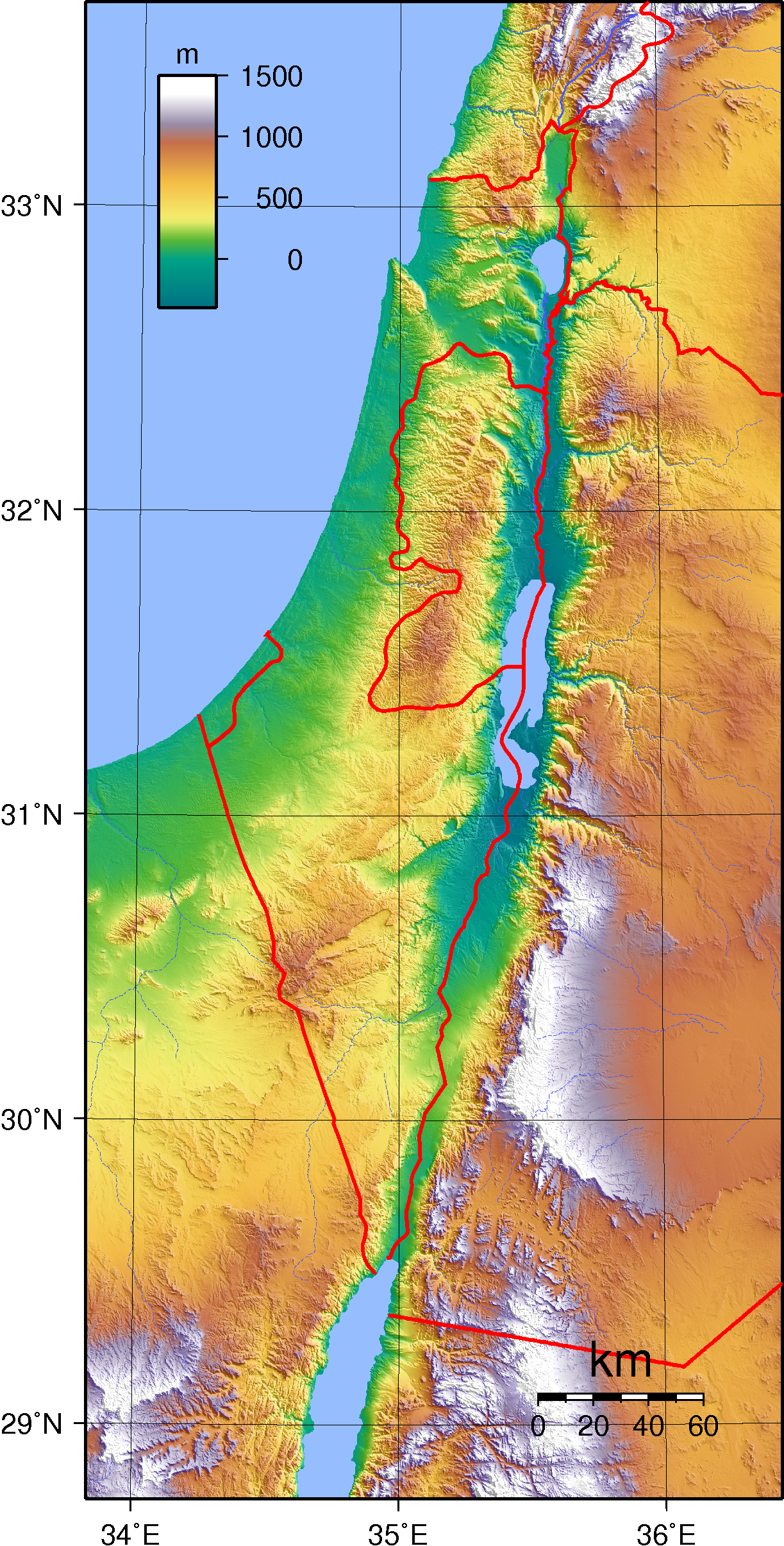 [/et_social_share_media]
[/et_social_share_media]
Topographic map of Israel. Created with GMT from SRTM data.
[et_social_share_media]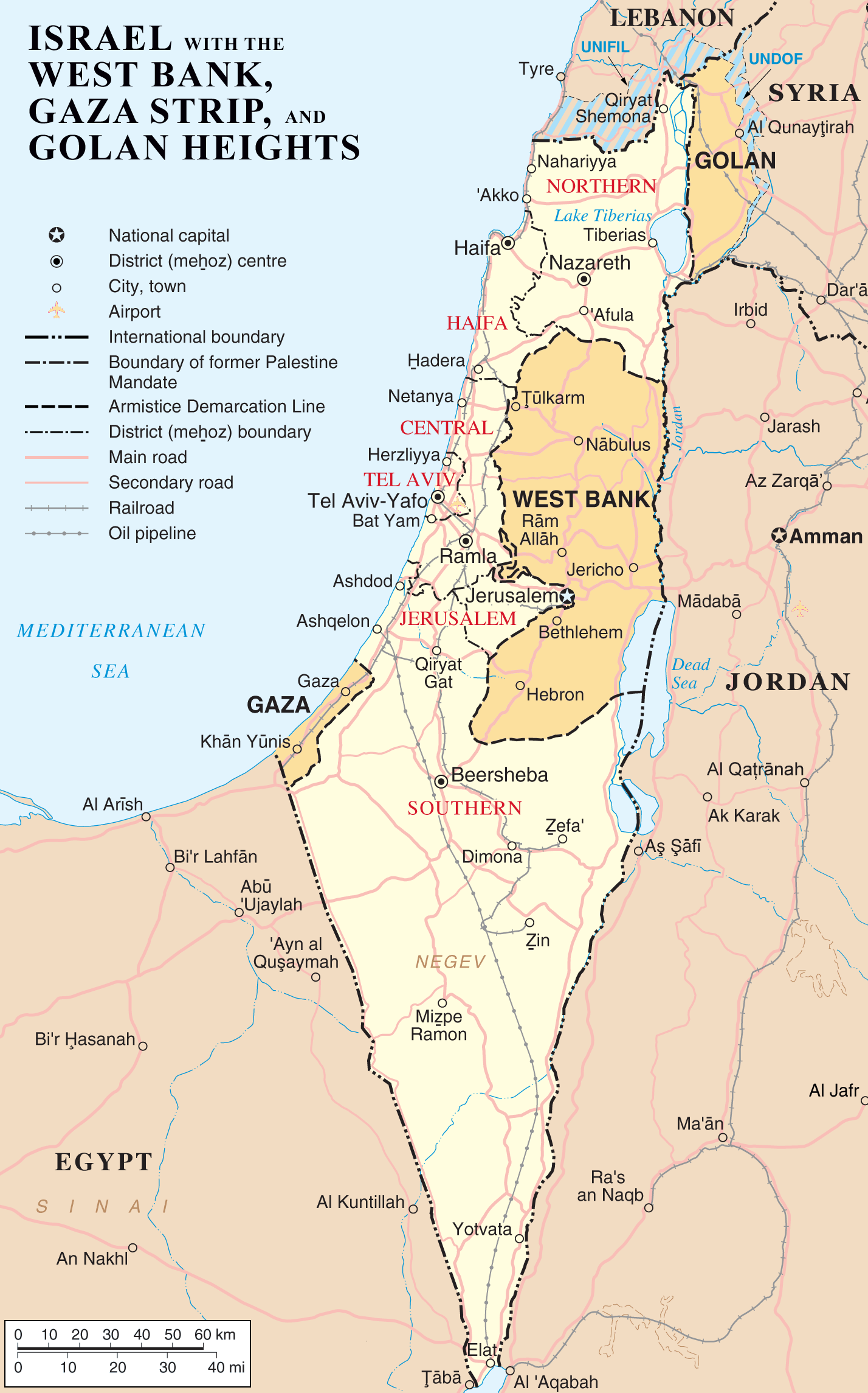 [/et_social_share_media]
[/et_social_share_media]
Map of Israel, the Palestinian territories (West Bank and Gaza Strip), the Golan Heights, and portions of neighbouring countries. Also United Nations deployment areas in countries adjoining Israel or Israeli-held territory, as of January 2004.
Here’s a great 3-D video regarding return of the West Bank and “Defensible Borders”