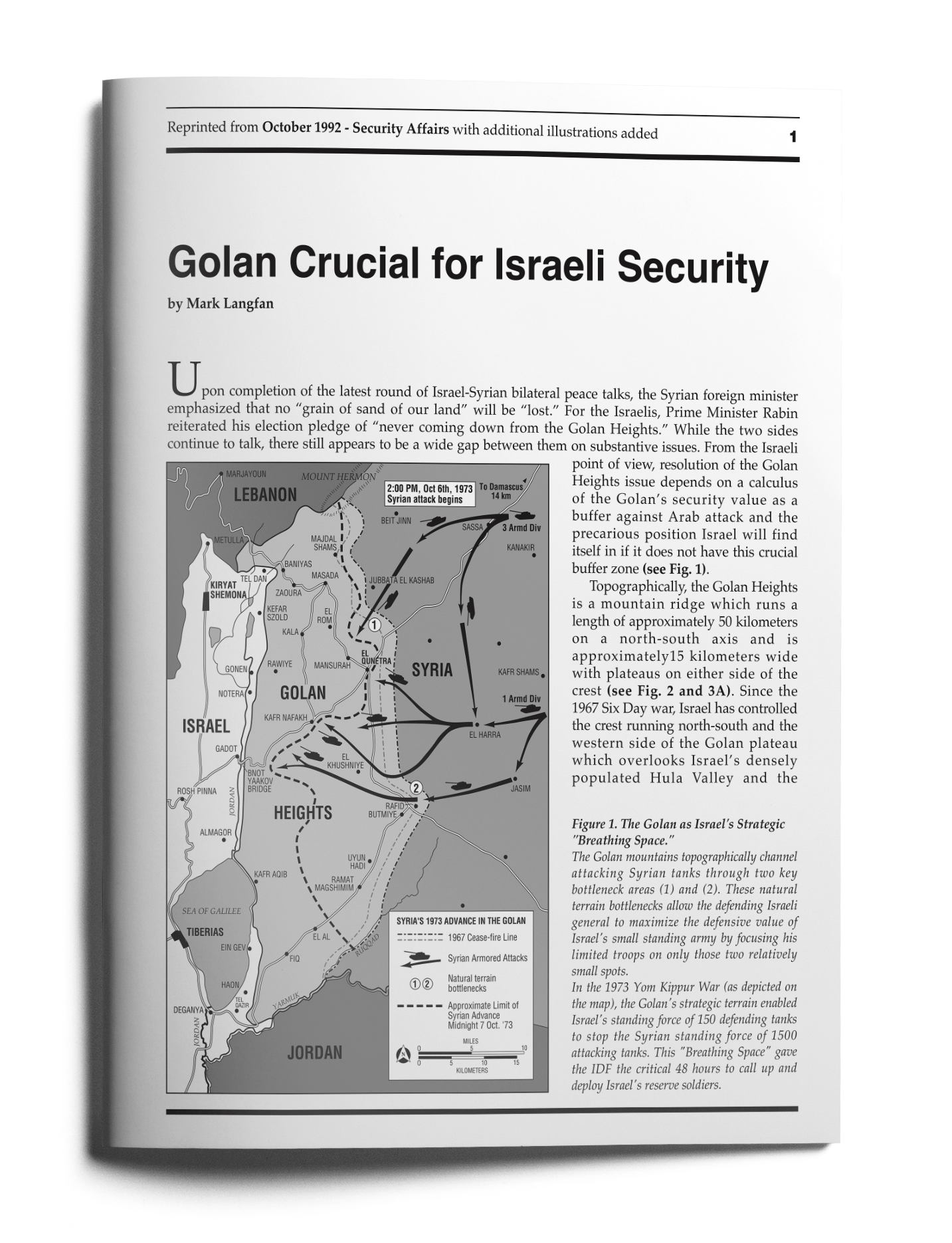
Upon completion of the latest round of Israel-Syrian bilateral peace talks, the Syrian foreign minister emphasized that no “grain of sand of our land” will be “lost.” For the Israelis, Prime Minister Rabin reiterated his election pledge of “never coming down from the Golan Heights.” While the two sides continue to talk, there still appears to be a wide gap between them on substantive issues. From the Israeli point of view, resolution of the Golan Heights issue depends on a calculus of the Golan’s security value as a buffer against Arab attack and the precarious position Israel will find itself in if it does not have this crucial buffer zone (see Fig. 1).
 [/et_social_share_media]
Figure 1.The Golan as Israel’s Strategic "Breathing Space."
The Golan mountains topographically channel attacking Syrian tanks through two key bottleneck areas (1) and (2). These natural terrain bottlenecks allow the defending Israeli general to maximize the defensive value of Israel’s small standing army by focusing his limited troops on only those two relatively small spots.
In the 1973 Yom Kippur War (as depicted on the map), the Golan’s strategic terrain enabled Israel’s standing force of 150 defending tanks to stop the Syrian standing force of 1500 attacking tanks. This "Breathing Space" gave the IDF the critical 48 hours to call up and deploy Israel’s reserve soldiers.
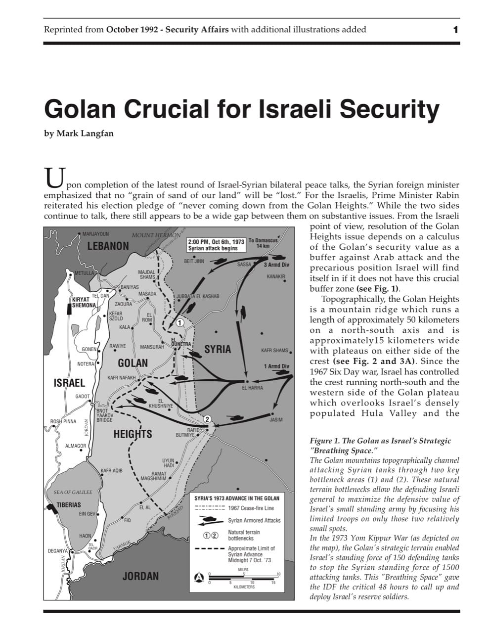
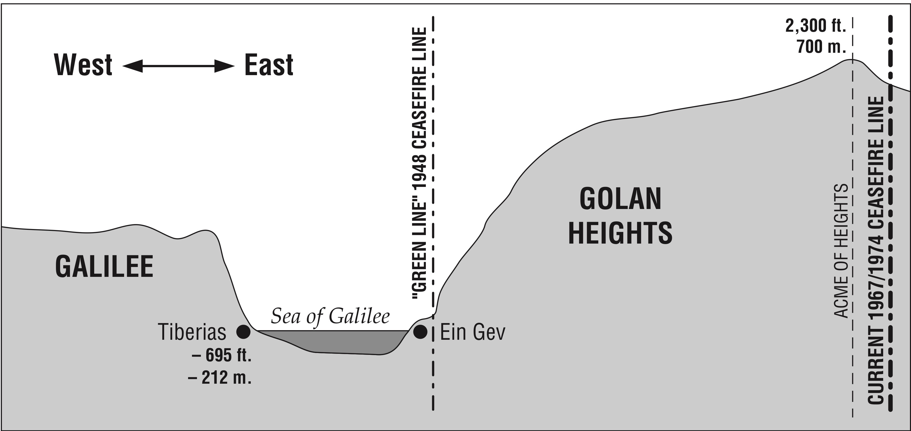
Topographically, the Golan Heights is a mountain ridge which runs a length of approximately 50 kilometers on a north-south axis and is approximately15 kilometers wide with plateaus on either side of the crest (see Fig. 2 and 3A). Since the 1967 Six Day war, Israel has controlled the crest running north-south and the western side of the Golan plateau which overlooks Israel’s densely populated Hula Valley and the northern shore of the Sea of Galilee.
 [/et_social_share_media]
Figure 2.The Golan Heights as Israel’s Strategic "Watershed" and "Perch."
The topographical slope and commanding position of the Golan Heights is key to understanding their supreme strategic value as Israel’s "Watershed" (see also Fig. 3) and as the strategic "Perch" overlooking the upper Galilee and the entire North of Israel.
 [/et_social_share_media]
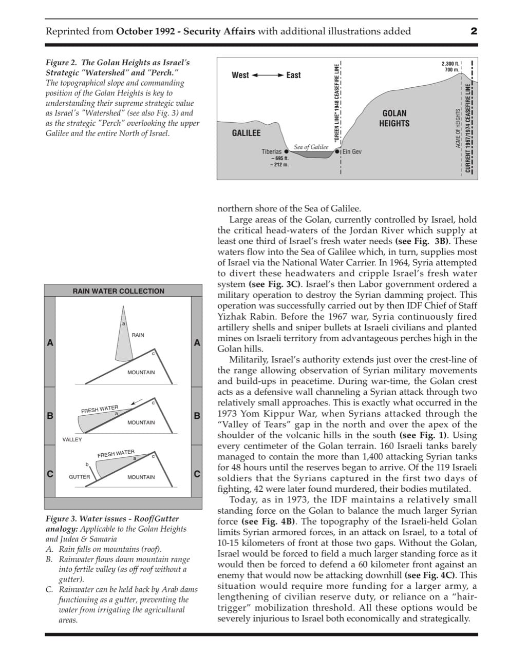
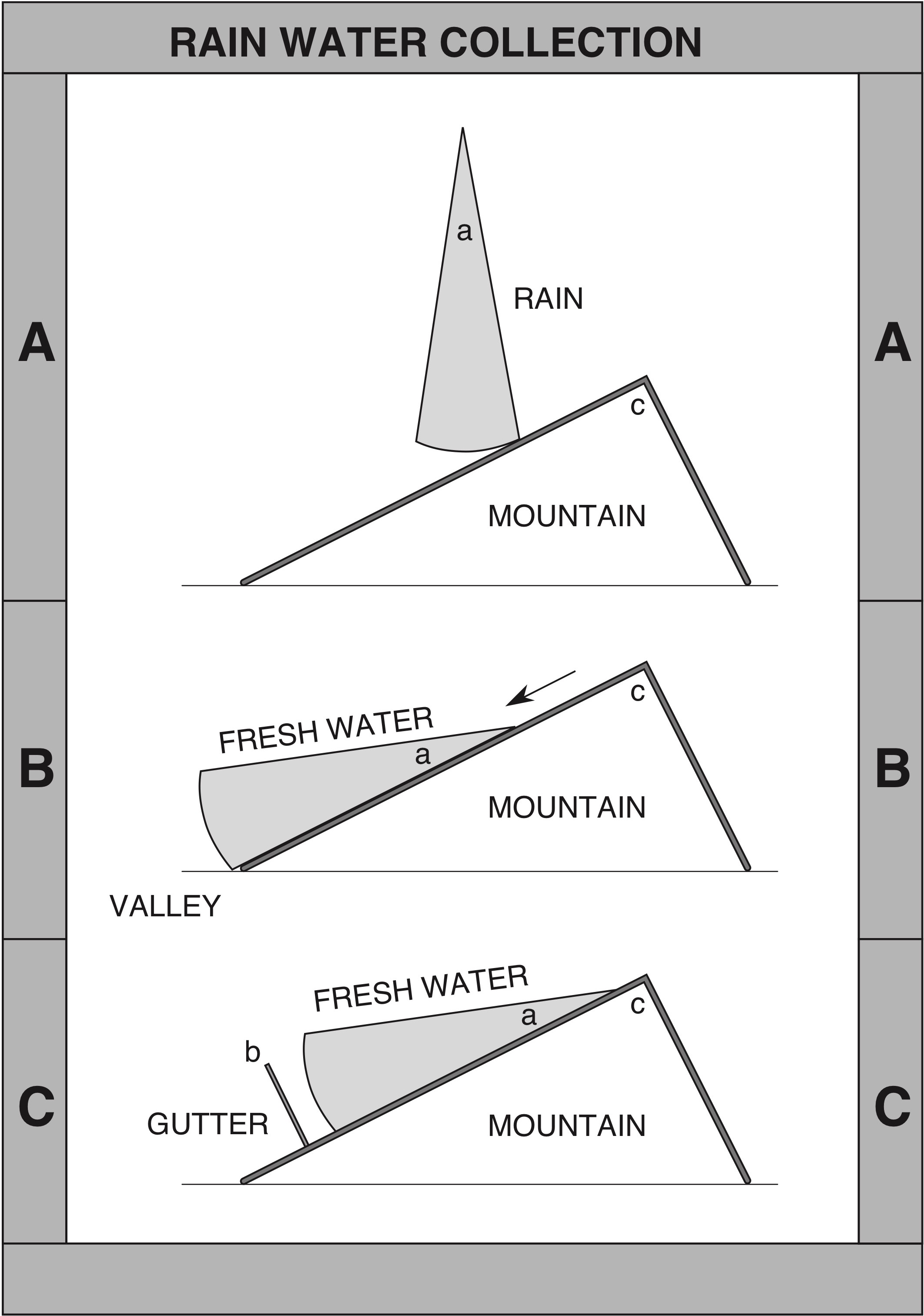
Figure 3.Water issues - Roof/Gutter analogy: Applicable to the Golan Heights and Judea & Samaria
- A. Rain falls on mountains (roof).
- B. Rainwater flows down mountain range into fertile valley (as off roof without a gutter).
- C. Rainwater can be held back by Arab dams functioning as a gutter, preventing the water from irrigating the agricultural areas.
Large areas of the Golan, currently controlled by Israel, hold the critical head-waters of the Jordan River which supply at least one third of Israel’s fresh water needs (see Fig. 3B). These waters flow into the Sea of Galilee which, in turn, supplies most of Israel via the National Water Carrier. In 1964, Syria attempted to divert these headwaters and cripple Israel’s fresh water system (see Fig. 3C). Israel’s then Labor government ordered a military operation to destroy the Syrian damming project. This operation was successfully carried out by then IDF Chief of Staff Yizhak Rabin. Before the 1967 war, Syria continuously fired artillery shells and sniper bullets at Israeli civilians and planted mines on Israeli territory from advantageous perches high in the Golan hills.
Militarily, Israel’s authority extends just over the crest-line of the range allowing observation of Syrian military movements and build-ups in peacetime. During war-time, the Golan crest acts as a defensive wall channeling a Syrian attack through two relatively small approaches. This is exactly what occurred in the 1973 Yom Kippur War, when Syrians attacked through the “Valley of Tears” gap in the north and over the apex of the shoulder of the volcanic hills in the south (see Fig. 1). Using every centimeter of the Golan terrain. 160 Israeli tanks barely managed to contain the more than 1,400 attacking Syrian tanks for 48 hours until the reserves began to arrive. Of the 119 Israeli soldiers that the Syrians captured in the first two days of fighting, 42 were later found murdered, their bodies mutilated.
Today, as in 1973, the IDF maintains a relatively small standing force on the Golan to balance the much larger Syrian force (see Fig. 4B). The topography of the Israeli-held Golan limits Syrian armored forces, in an attack on Israel, to a total of 10-15 kilometers of front at those two gaps. Without the Golan, Israel would be forced to field a much larger standing force as it would then be forced to defend a 60 kilometer front against an enemy that would now be attacking downhill (see Fig. 4C). This situation would require more funding for a larger army, a lengthening of civilian reserve duty, or reliance on a “hair- trigger” mobilization threshold. All these options would be severely injurious to Israel both economically and strategically.
 [/et_social_share_media]
SCHEMATIC REPRESENTATION
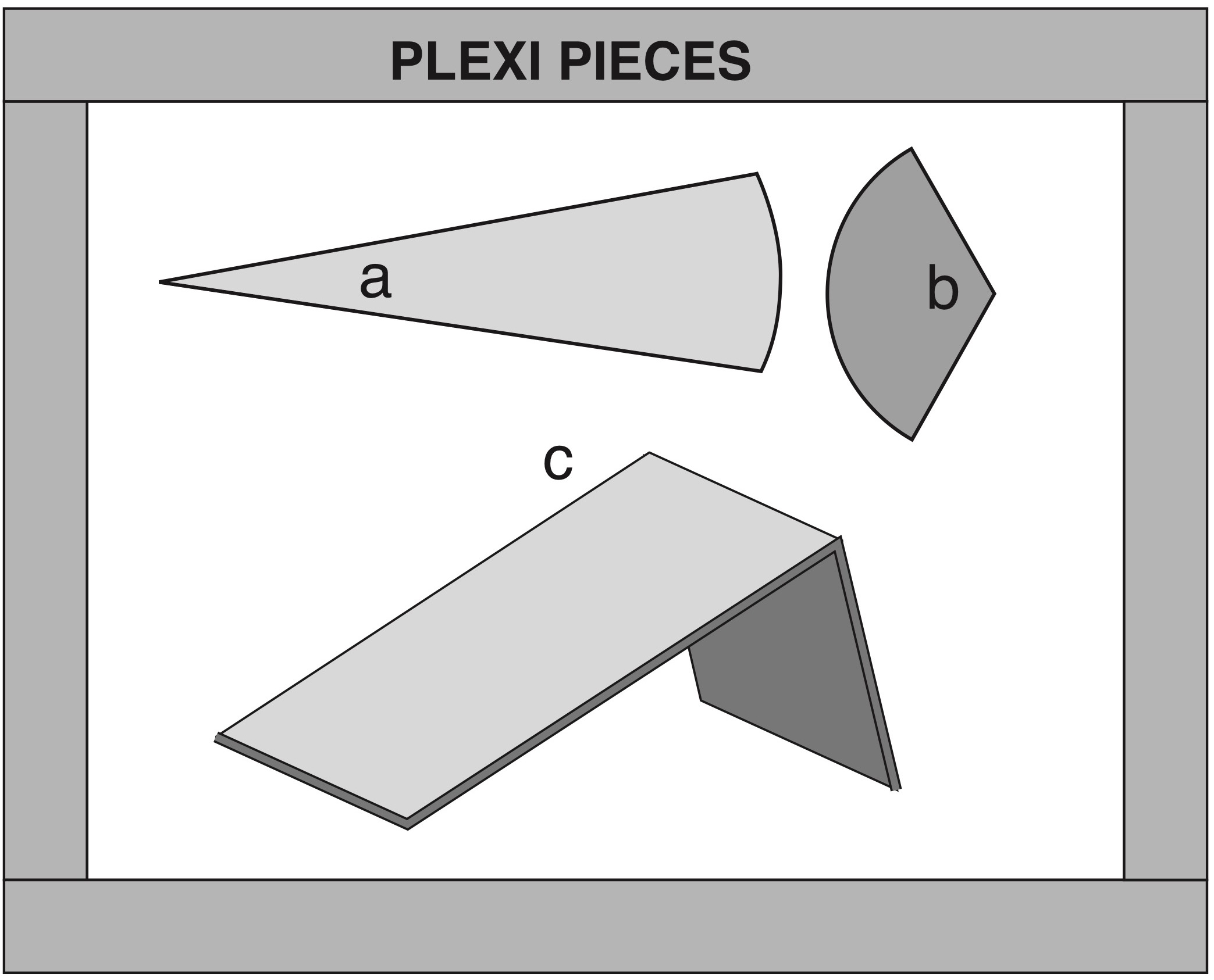
Schematic clarifications have been added to the reprint of this article, originally published in "Security Affairs."
The simplified elements used here have been produced in plexiglass, well suited for demonstration of the principles of the system to a limited audience. The scale of the Plexi Pieces is such that the pieces can be used on a standard 1:250,000 map of Israel. The pieces, with instructions, can be obtained from the author, or from the organizations listed on the back page.
 [/et_social_share_media]
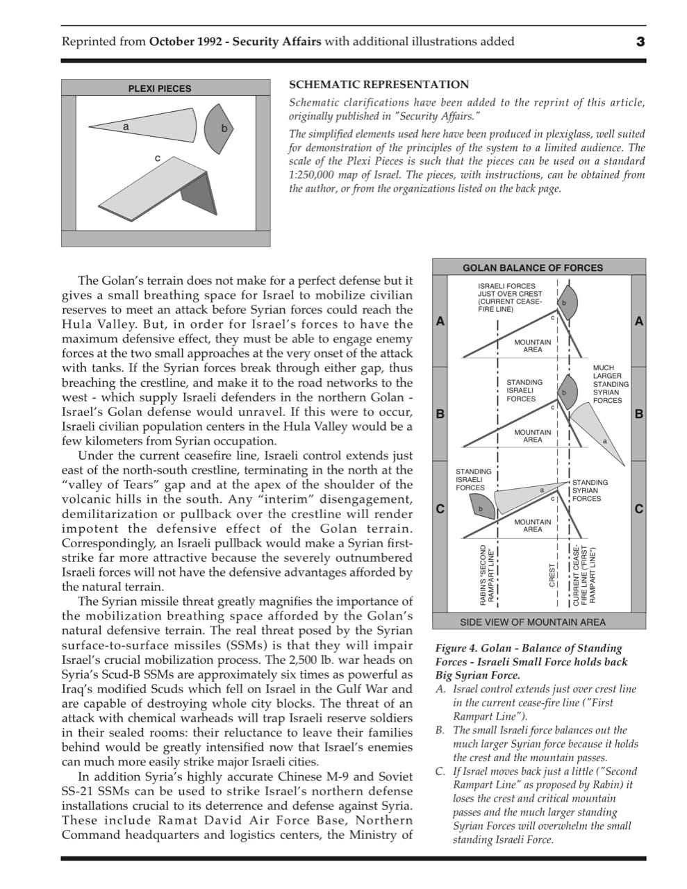
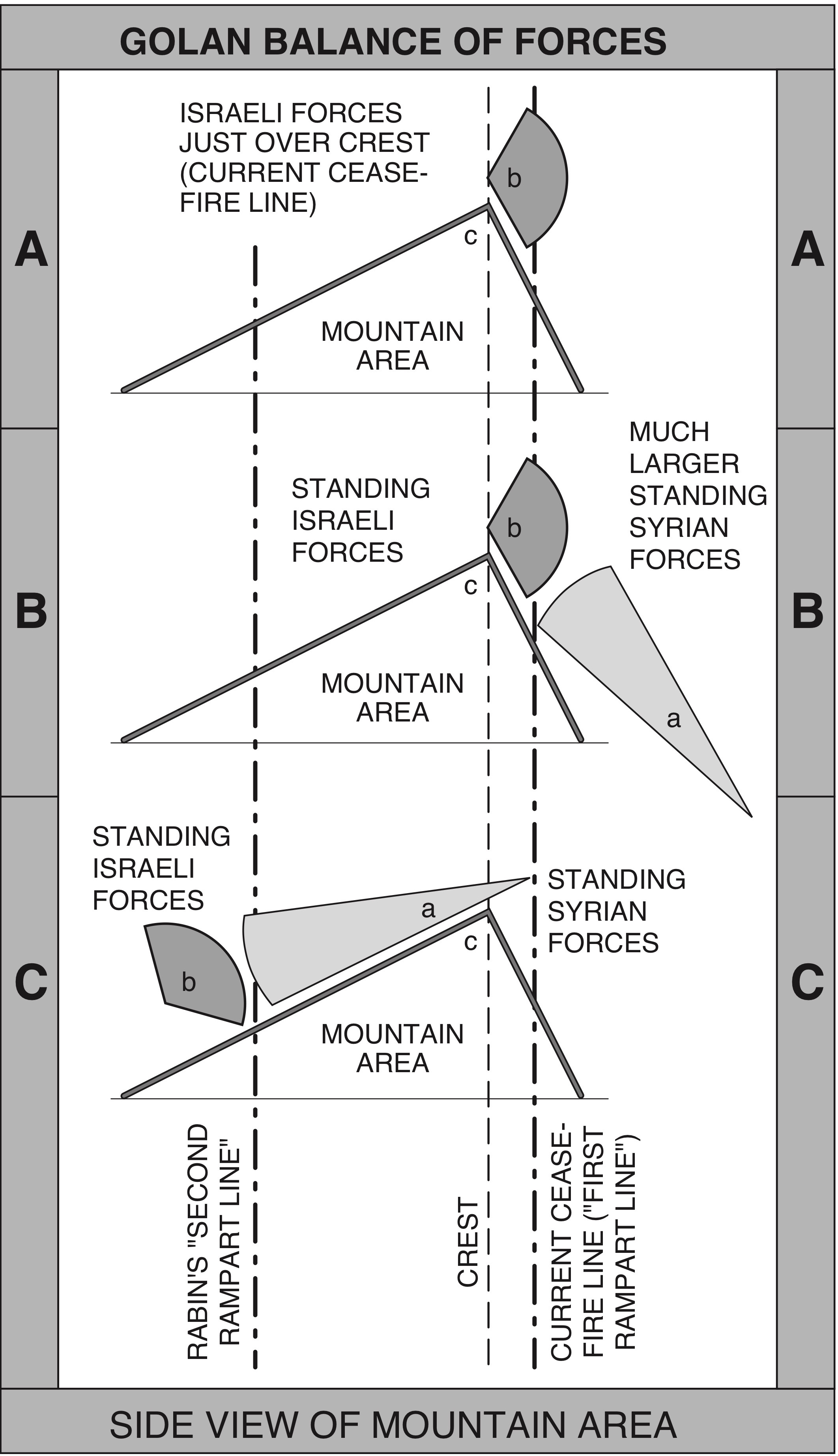
Figure 4.Golan - Balance of Standing Forces - Israeli Small Force holds back Big Syrian Force.
- A. Israel control extends just over crestline in the current cease-fire line ("First Rampart Line").
- B. The small Israeli force balances out the much larger Syrian force because it holds the crest and the mountain passes.
- C. If Israel moves back just a little ("Second Rampart Line" as proposed by Rabin) it loses the crest and critical mountain passes and the much larger standing Syrian Forces will overwhelm the small standing Israeli Force.
The Golan’s terrain does not make for a perfect defense but it gives a small breathing space for Israel to mobilize civilian reserves to meet an attack before Syrian forces could reach the Hula Valley. But, in order for Israel’s forces to have the maximum defensive effect, they must be able to engage enemy forces at the two small approaches at the very onset of the attack with tanks. If the Syrian forces break through either gap, thus breaching the crestline, and make it to the road networks to the west - which supply Israeli defenders in the northern Golan - Israel’s Golan defense would unravel. If this were to occur, Israeli civilian population centers in the Hula Valley would be a few kilometers from Syrian occupation.
Under the current ceasefire line, Israeli control extends just east of the north-south crestline, terminating in the north at the “valley of Tears” gap and at the apex of the shoulder of the volcanic hills in the south. Any “interim” disengagement, demilitarization or pullback over the crestline will render impotent the defensive effect of the Golan terrain. Correspondingly, an Israeli pullback would make a Syrian first- strike far more attractive because the severely outnumbered Israeli forces will not have the defensive advantages afforded by the natural terrain.
The Syrian missile threat greatly magnifies the importance of the mobilization breathing space afforded by the Golan’s natural defensive terrain. The real threat posed by the Syrian surface-to-surface missiles (SSMs) is that they will impair Israel’s crucial mobilization process. The 2,500 lb. war heads on Syria’s Scud-B SSMs are approximately six times as powerful as Iraq’s modified Scuds which fell on Israel in the Gulf War and are capable of destroying whole city blocks. The threat of an attack with chemical warheads will trap Israeli reserve soldiers in their sealed rooms: their reluctance to leave their families behind would be greatly intensified now that Israel’s enemies can much more easily strike major Israeli cities.
In addition Syria’s highly accurate Chinese M-9 and Soviet SS-21 SSMs can be used to strike Israel’s northern defense installations crucial to its deterrence and defense against Syria. These include Ramat David Air Force Base, Northern Command headquarters and logistics centers, the Ministry of Defense headquarters in Tel Aviv, various mobilization depots and early warning radar and electronic intelligence-gathering stations (see Fig. 5).
 [/et_social_share_media]
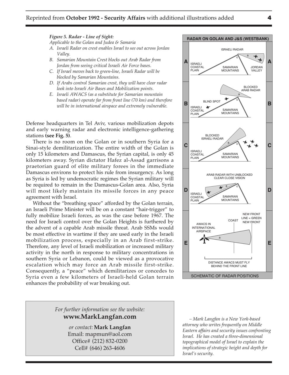
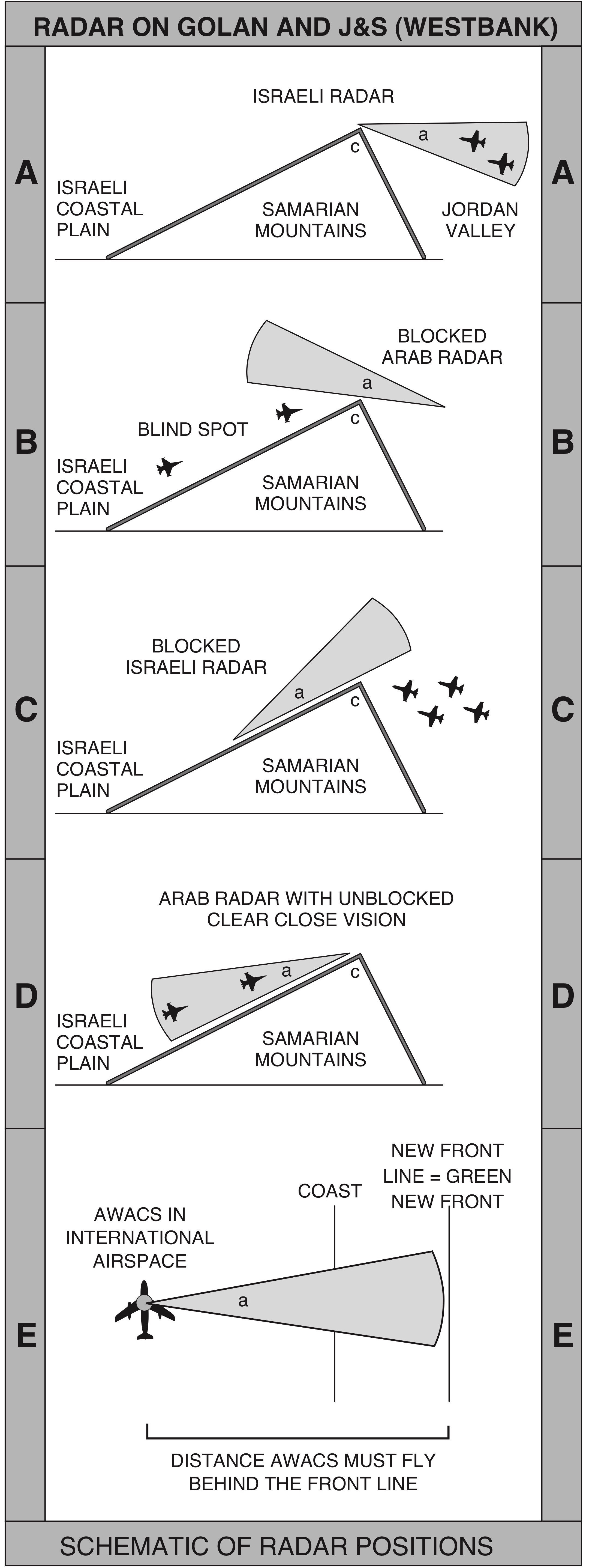
Figure 5.TRadar - Line of Sight:
Applicable to the Golan and Judea & Samaria
- A. Israeli Radar on crest enables Israel to see out across Jordan Valley.
- B. Samarian Mountain Crest blocks out Arab Radar from Jordan from seeing critical Israeli Air Force bases.
- C. If Israel moves back to green-line, Israeli Radar will be blocked by Samarian Mountains.
- D. IfArabscontrolSamariancrest,they will have clear radar look into Israeli Air Bases and Mobilization points.
- E. Israeli AWACS (as a substitute for Samarian mountain based radar) operate far from front line (70 km) and therefore will be in international airspace and extremely vulnerable.
There is no room on the Golan or in southern Syria for a Sinai-style demilitarization. The entire width of the Golan is only 15 kilometers and Damascus, the Syrian capital, is only 45 kilometers away. Syrian dictator Hafez al-Assad garrisons a praetorian guard of elite military forees in the immediate Damascus environs to protect his rule from insurgency. As long as Syria is led by undemocratic regimes the Syrian military will be required to remain in the Damascus-Golan area. Also, Syria will most likely maintain its missile forces in any peace agreement with Israel.
Without the “breathing space” afforded by the Golan terrain, an Israeli Prime Minister will be on a constant “hair-trigger” to fully mobilize Israeli forces, as was the case before 1967. The need for Israeli control over the Golan Heights is furthered by the advent of a capable Arab missile threat. Arab SSMs would be most effective in wartime if they are used early in the Israeli mobilization process, especially in an Arab first-strike. Therefore, any level of Israeli mobilization or increased military activity in the north in response to military concentrations in southern Syria or Lebanon, could be viewed as a provocative escalation which may force an Arab missile first-strike. Consequently, a “peace” which demilitarizes or concedes to Syria even a few kilometers of Israeli-held Golan terrain enhances the probability of war breaking out.