Basic Topographic Map
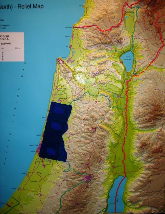 [/et_social_share_media]
Basic Topographic Map, Blue Patch = Pre-67 - Israel - 70% Israeli Population/80% of Israel’s Industrial Base
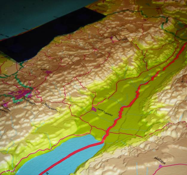 [/et_social_share_media]
Zoom of Northern Lobe of West Bank from South Eastern Vector, Blue Patch = Pre-67 - Israel - 70% Israeli Population/80% of Israel’s Industrial Base
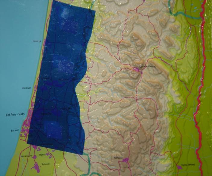 [/et_social_share_media]
Pre-67 Midsection & West Bank, Blue Patch = Pre-67 - Israel - 70% Israeli Population/80% of Israel’s Industrial Base
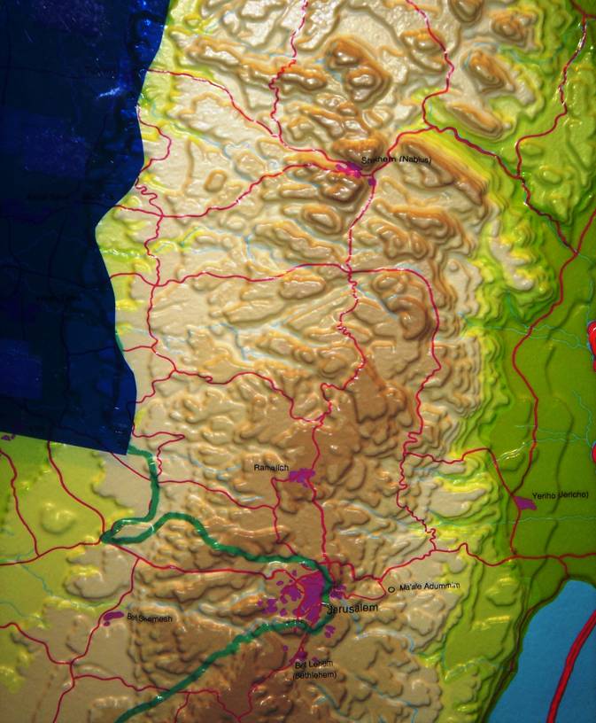 [/et_social_share_media]
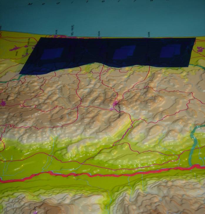
Zoom of North Lobe of West Bank, Blue Patch = Pre-67 - Israel - 70% Israeli Population/80% of Israel’s Industrial Base
 [/et_social_share_media]
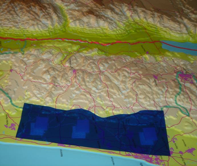
View from East Vector, Blue Patch = Pre-67 - Israel - 70% Israeli Population/80% of Israel’s Industrial Base
 [/et_social_share_media]
View from West Vector, Blue Patch = Pre-67 - Israel - 70% Israeli Population/80% of Israel’s Industrial Base
 [/et_social_share_media]
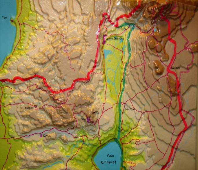
Zoomed in focus on Northern Israel, South Lebanon, Golan Heights
 [/et_social_share_media]
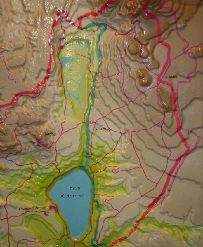
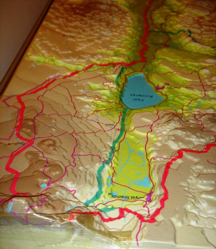
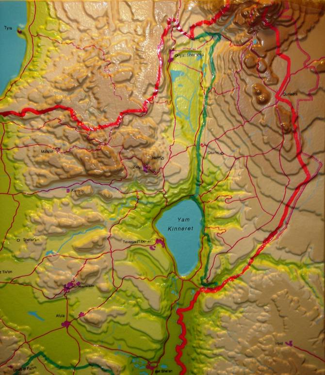
Golan Heights & Hula Valley
 [/et_social_share_media]
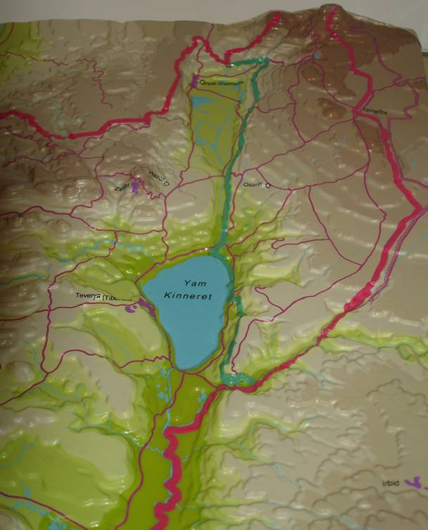
Golan Heights Hula Valley, View from North Vector
 [/et_social_share_media]
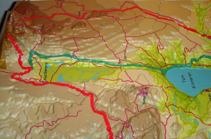
Golan Heights Hula Valley, View from South Vector
 [/et_social_share_media]
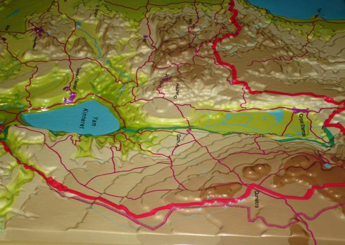
Golan Heights Hula Valley, View from West Vector
 [/et_social_share_media]
Golan Heights Hula Valley, View from East Vector
 [/et_social_share_media]
Galilee/Hula Valley/Southern Lebanon/Golan Heights
Plexi pieces demonstration
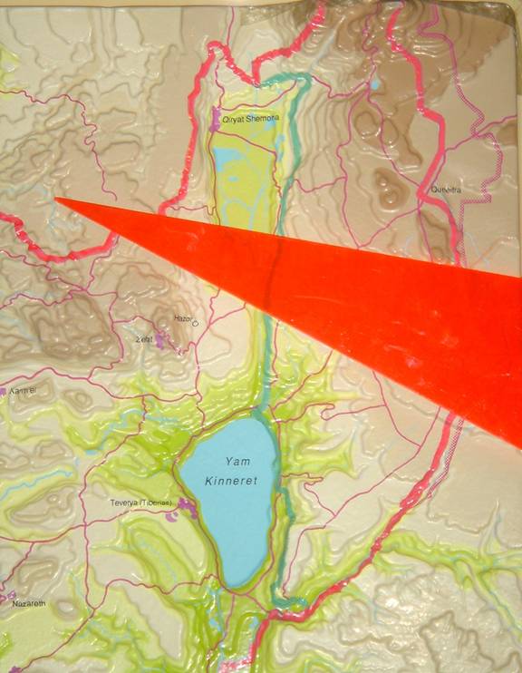
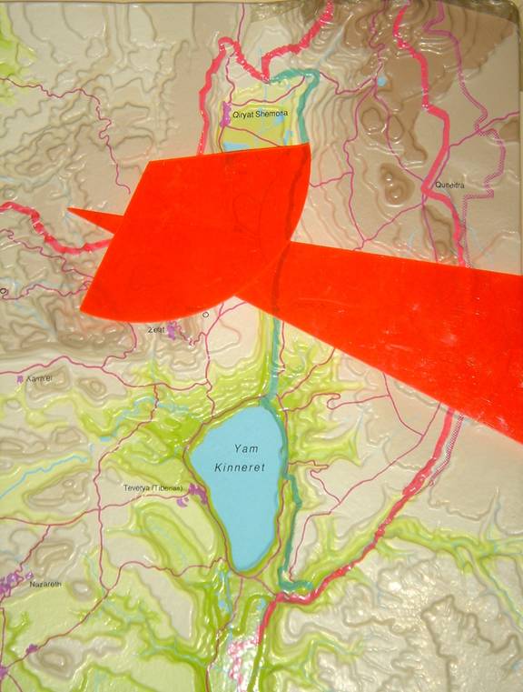
Approximately one-half (50%) of Israel’s water supply is derived and dependent on the West bank Water management and 40% is derived from the Golan Heights. The topographical slope and commanding position of the Golan Heights is key to understanding their supreme strategic value as Israel’s "Watershed" and as the strategic "Perch" overlooking the upper Galilee and the entire North of Israel. The Use of Plexi Pieces make it possible to explain these issues in a clear manner: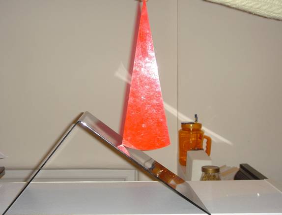 [/et_social_share_media]
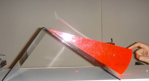
Rain fall on the Western slopes of the Mountains of the West Bank.
 [/et_social_share_media]
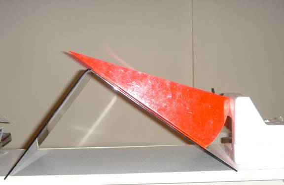
With Israeli Control of the West Bank Mountain Aquifer Water topographically flows underground westward to replenish the Coastal Aquifer
 [/et_social_share_media]
A Palestinian West Bank State would control and overpump all of the water reservoirs of the West Bank Mountain Aquifers and stop the flow of fresh water to the Pre-67 Coastal Aquifer.
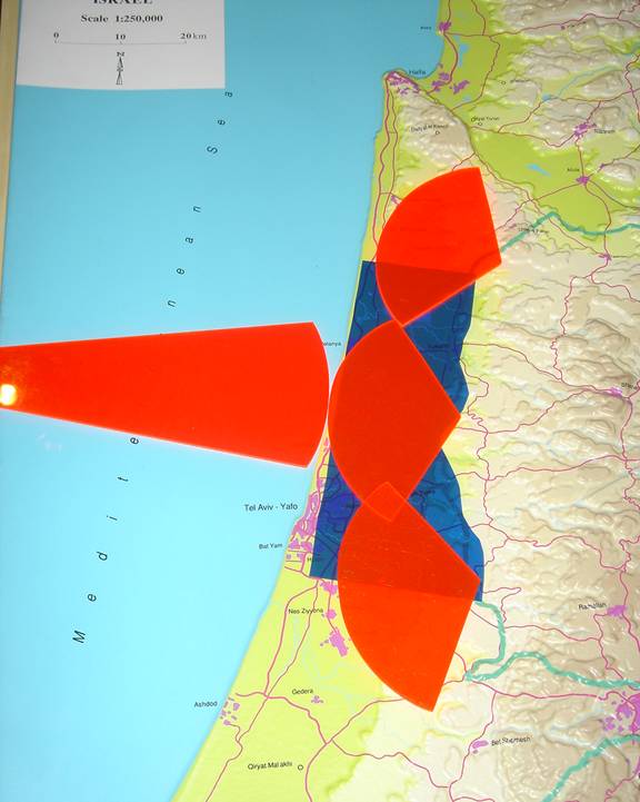 [/et_social_share_media]
Mediterranean Sea Saline - pushes eastward West Bank Mountain Aquifer - Fresh Water pushes westward Underground Coastal Aquifer in Osmotic Fresh Water Equilibrium
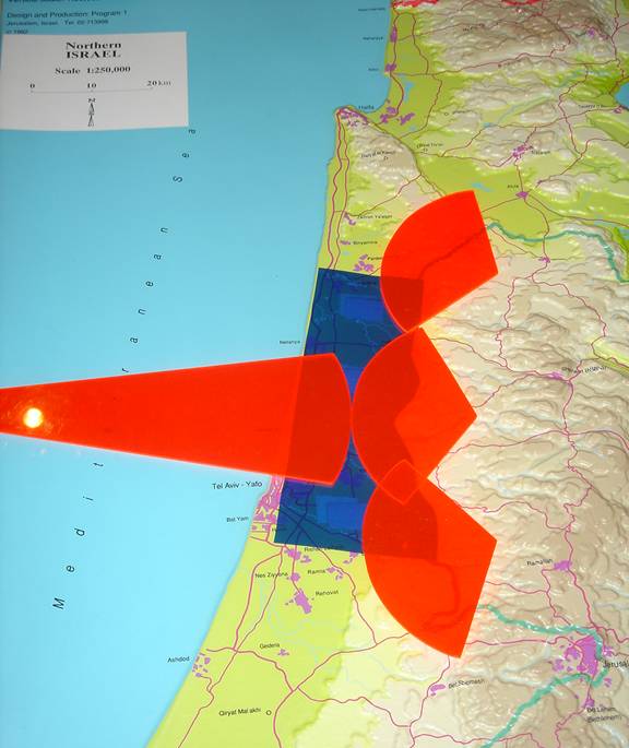 [/et_social_share_media]
Palestinian West Bank State overpumping of West Bank Mountain Aquifer reduces pure fresh water westward osmotic pressure against the Mediterranean Sea Saline pushing eastward producing salt water intrusion eastward into the Coastal Aquifer
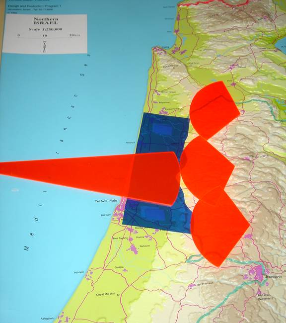 [/et_social_share_media]
Pre-67 Israel Coastal Aquifer destroyed by Palestinian West Bank fresh water overpumping of the West Bank Mountain Aquifer and the resulting Mediterranean Salt Water Intrusion destruction of the Coastal Aquifer
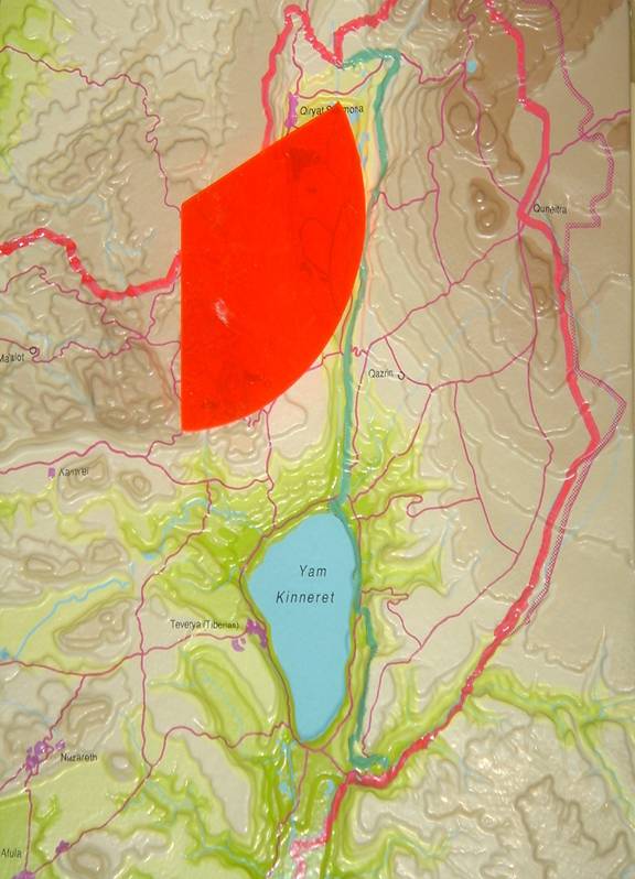 [/et_social_share_media]
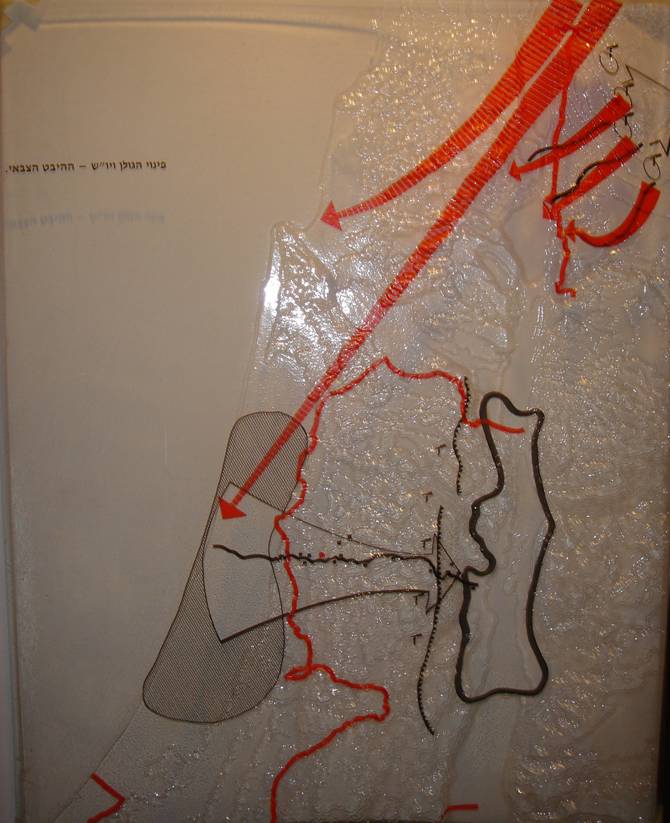
Hezbollah Hula Valley Katyusha Rocket Range
 [/et_social_share_media]
Syrian/Iranian Southern Golan Armoured Westward Attack
 [/et_social_share_media]
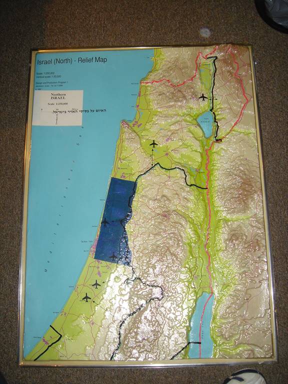
Combined Hezbollah Katyusha/Syria Iranian Armoured Attack
 [/et_social_share_media]
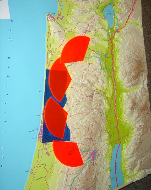
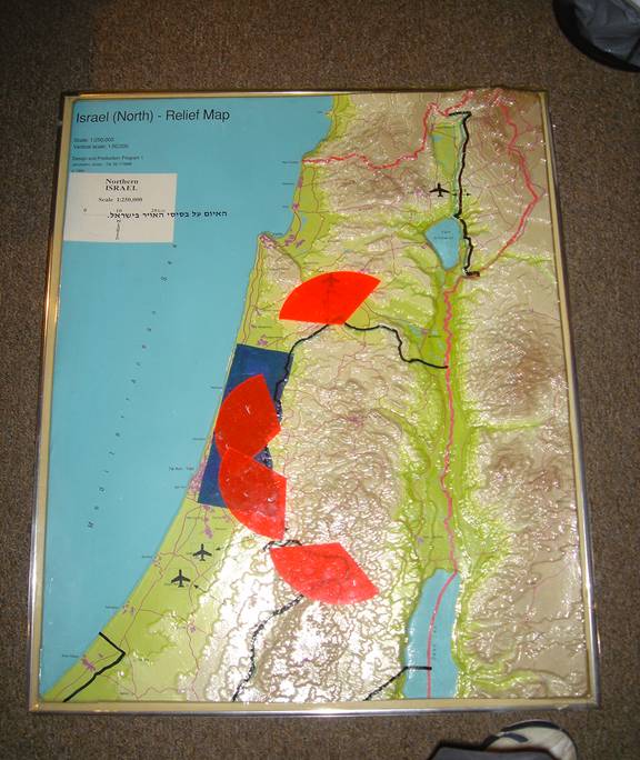
3D Topograhic Map with Air Base Overlay
 [/et_social_share_media]
Palestinian West Bank State Katyusha/Anti-Aircraft Rocket/Laser Designator Range into Pre-67 Israel
 [/et_social_share_media]
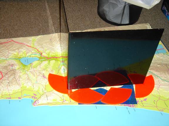
Air Base Overlay with Palestinian West Bank State Katyusha/Anti-Aircraft Rocket/Laser Designators Range into Pre-67 Israel
 [/et_social_share_media]
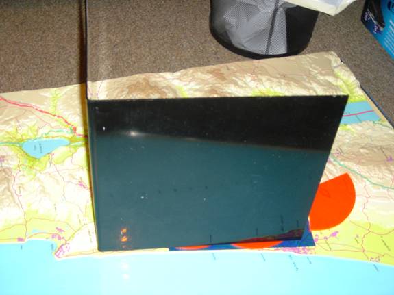
De jure Palestinian West Bank State Airspace
 [/et_social_share_media]
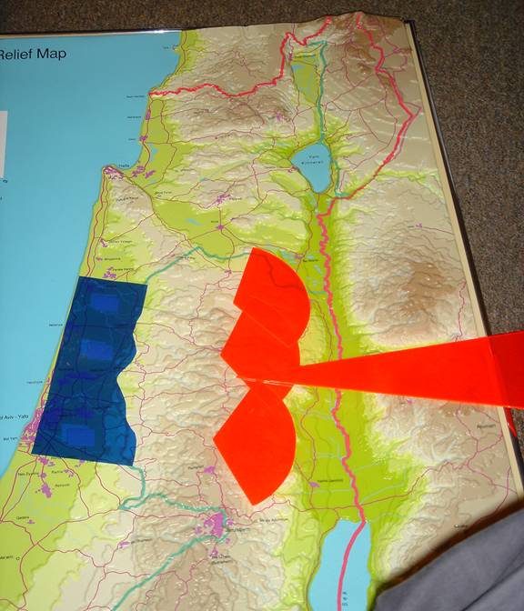
De facto Palestinian West Bank State Air Defense Umbrella puts Ramat David and entire Pre-67 Israeli Coastal Plain under a Palestinian Hamas West Bank State Air Defense Umbrella
 [/et_social_share_media]
Eastern Front Air Attack met over West Bank with current Israeli Air Defenses and Israeli Airspace
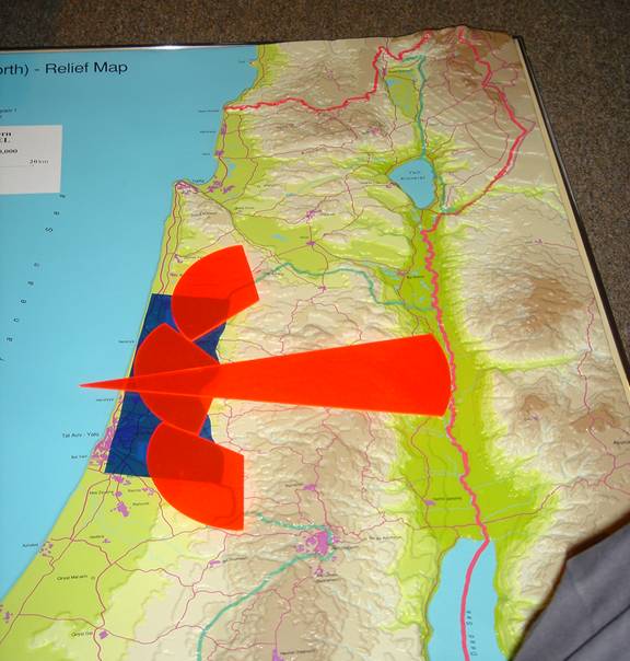 [/et_social_share_media]
With no Israeli West Bank Air Defenses or Airspace Eastern Front air attack cannot be met; therefore, Eastern Front Air Attack can destroy the Israel Coastal Plains which contain 70%* of Israeli Population/80% of the Israeli Industrial Base. *If Jerusalem is included, the Israeli kill percentage is even greater.
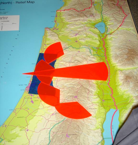 [/et_social_share_media]
With no Israeli West Bank Air Defenses or Airspace, Eastern Front Air Attack can destroy the Israel Coastal Plains which contain 70%* of Israeli Population/80% of the Israeli Industrial Base. *If Jerusalem is included, the Israeli kill percentage is even greater.
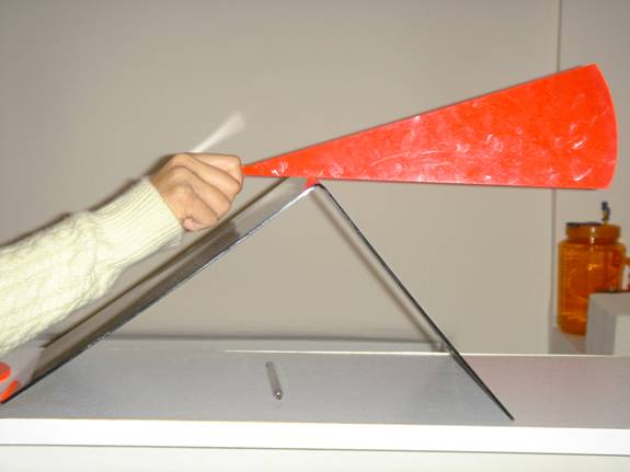 [/et_social_share_media]
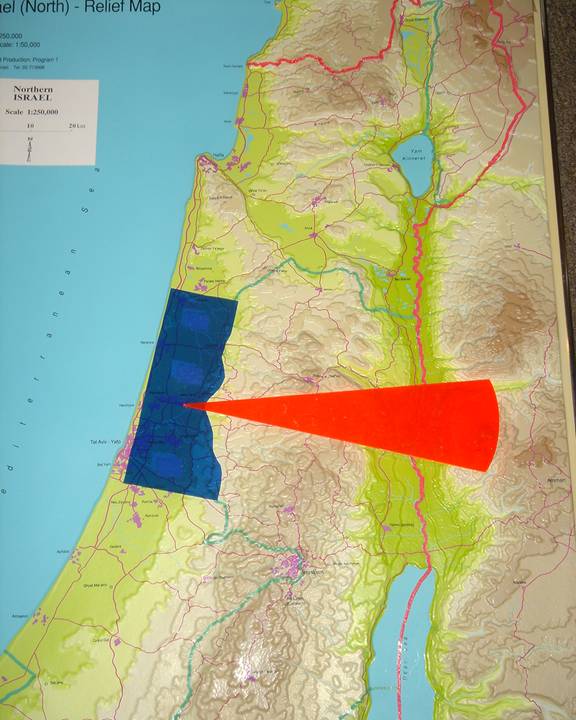
Israel Control of West Bank Mountains and crestline enables Israeli out-of-sight radar to scan to the opposing Jordanian crestline on the eastern side of the Jordan Valley
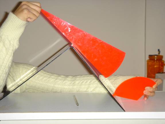 [/et_social_share_media]
With Israel’s line-of-sight control of West Bank Mountains Israel Air Force can “see” low- flying enemy planes approaching before the West Bank crestline so as to give IAF time to scramble interceptors and/or anti-aircraft missile before enemy aircraft reaches population-rich targets in the Coastal Plain
 [/et_social_share_media]
Without line-of-sight control energy aircraft can approach unseen until the crestline of West Bank Mountains leaving no time for IAF interceptors to meet attack
 [/et_social_share_media]
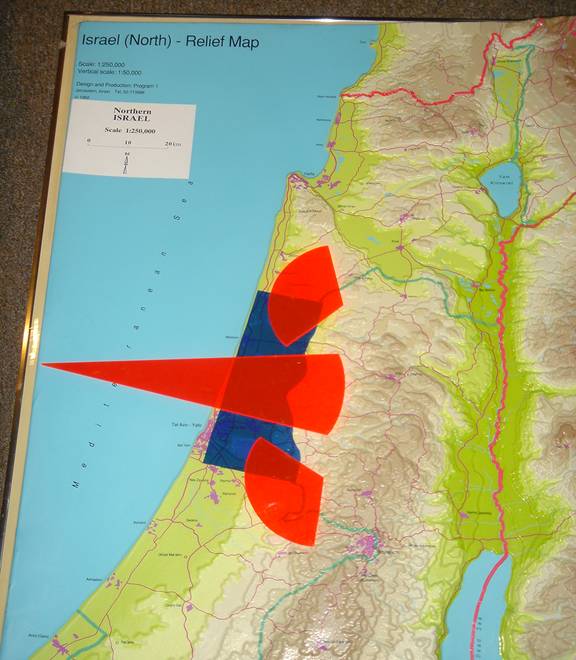
Phalcon/AWALS Operation envelope – Phalcon system must operate inside of large Israeli controlled stable protected airspace volume
 [/et_social_share_media]
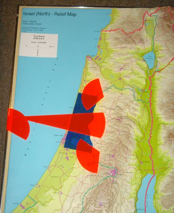
Palestinian West Bank State air defenses will push Phalcon/AWACS outside of Israel international airspace into the Mediterranean Sea
 [/et_social_share_media]
Such eviction of Phalcon/AWACS to non-Israeli territorial airspace opens the slow moving aircraft radar platform to simple sea-borne anti air missiles
Map Overlays
Overlays show strategic military air bases, water aquifers, military strategies, and population density: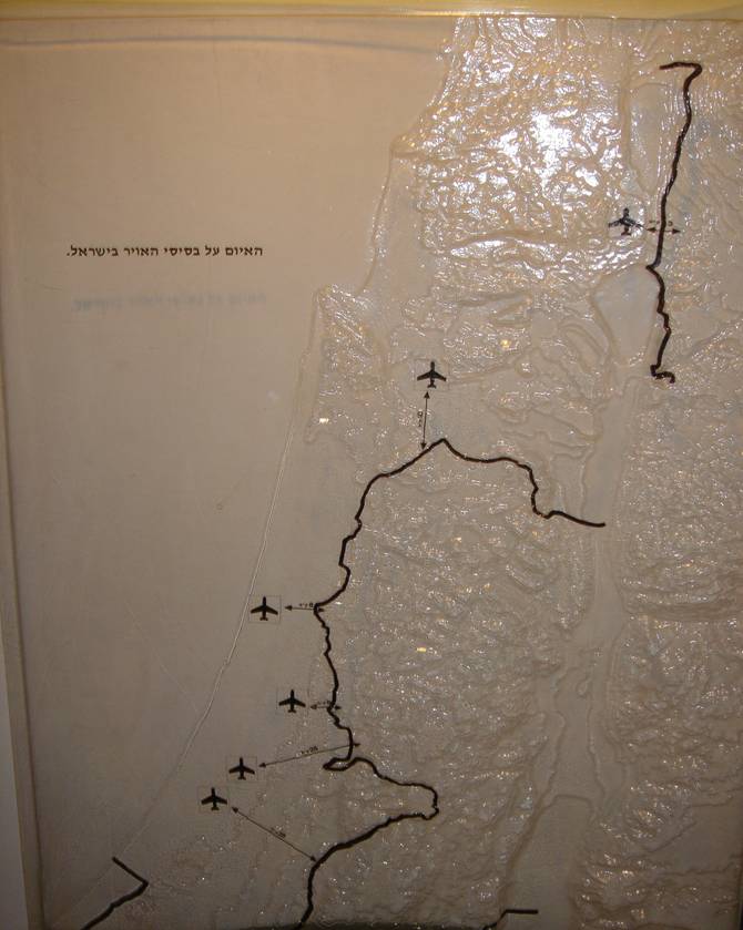 [/et_social_share_media]
Strategic Military Air Bases
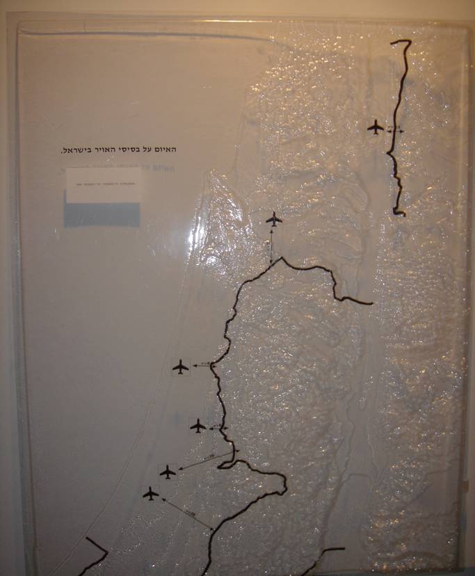 [/et_social_share_media]
Strategic Military Air Bases
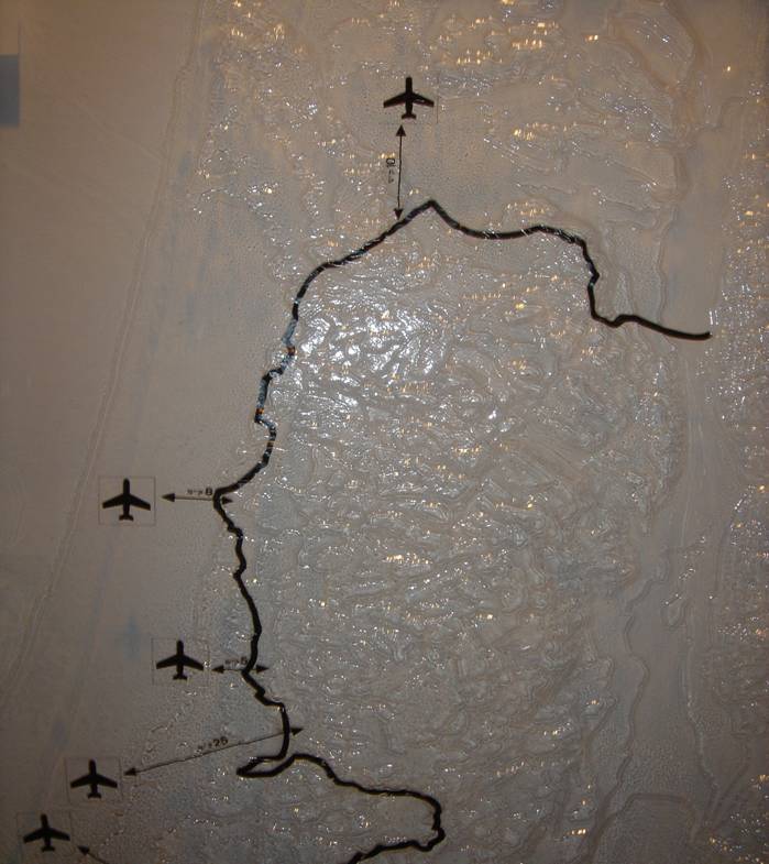 [/et_social_share_media]
Strategic Military Air Bases, Zoom Northern Lobe of West Bank
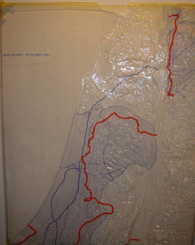 [/et_social_share_media]
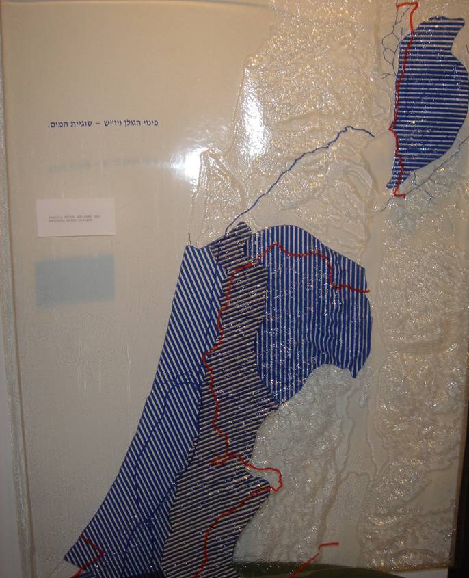
Israel Water Aquifer Overlay
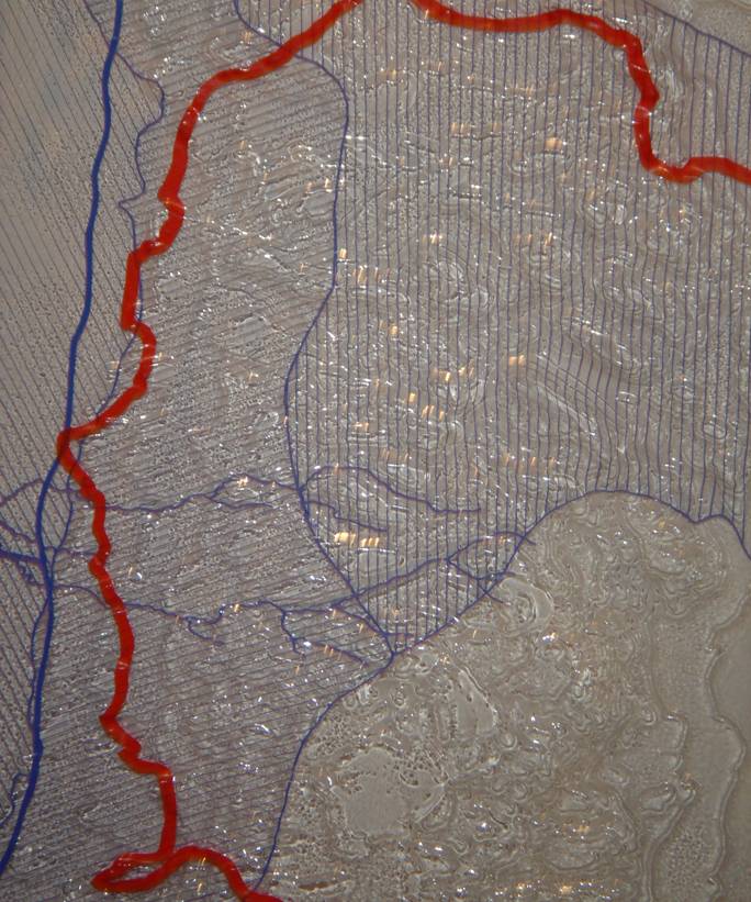 [/et_social_share_media]
Israel Water Aquifer Overlay, Zoom on Northern Lobe of West Bank
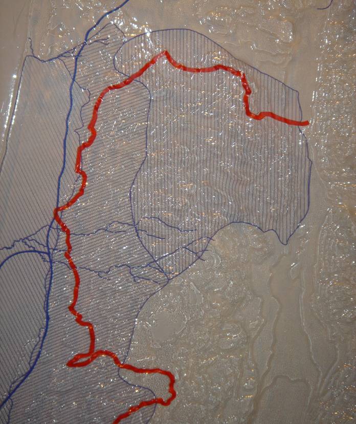 [/et_social_share_media]
Israel Water Aquifer Overlay, Zoom on Northern Lobe of West Bank
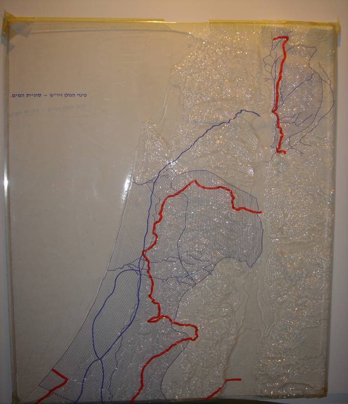 [/et_social_share_media]
Israel Water Aquifer Overlay, General Northern Aspect of Israel
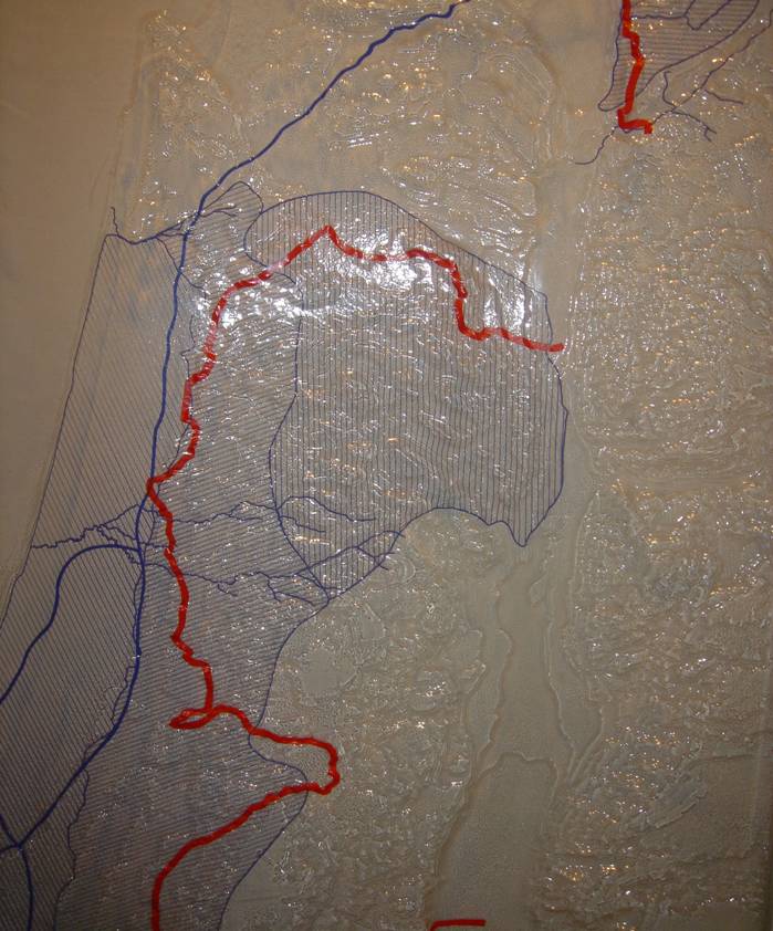 [/et_social_share_media]
Israel Water Aquifer Overlay, Zoom on Northern Israel
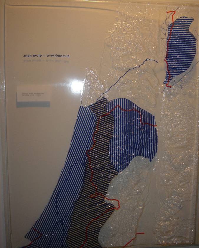 [/et_social_share_media]
Israel Water Aquifer Overlay (Opaque)
 [/et_social_share_media]
Israel Water Aquifer Overlay (Opaque)
 [/et_social_share_media]
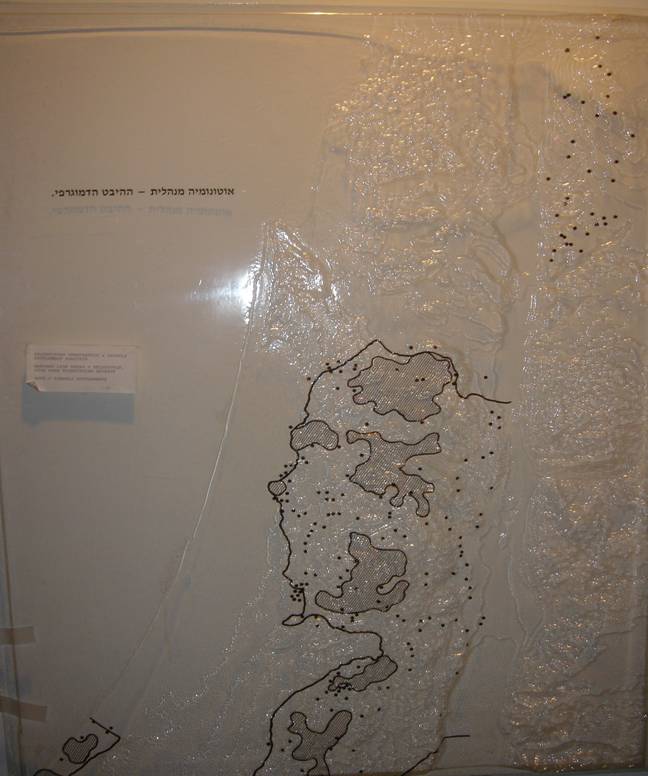
Israeli Settlements, High Density Palestinian Population Overlay
 [/et_social_share_media]
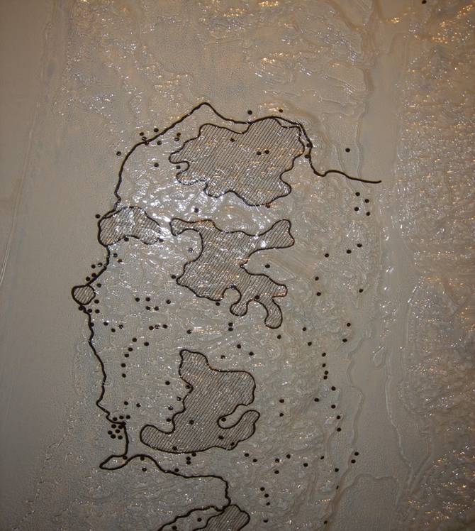
Israeli Settlements High Density Palestinian Population Overlay, Zoomed
 [/et_social_share_media]
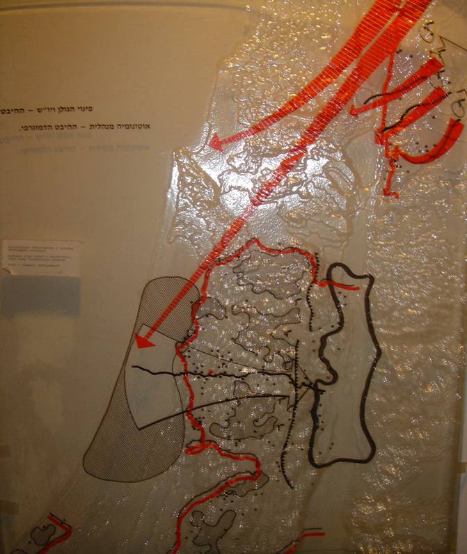
Zoom on North Lobe of West Bank, General Military Strategic with Trans-Samaria Highway Access to the Allon Line of Defense
 [/et_social_share_media]
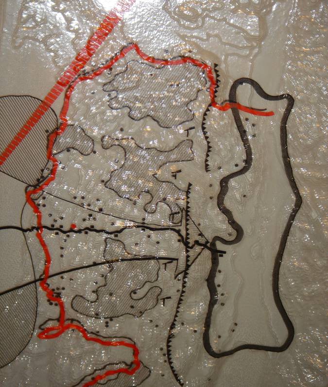
Product of Israeli Settlements & High Density Palestinian Population Overlay
 [/et_social_share_media]
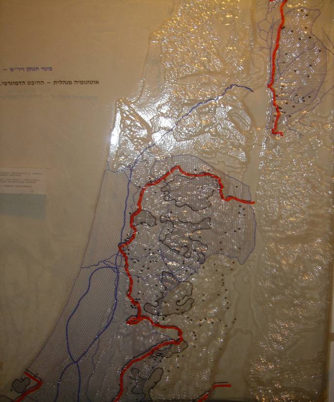
Product of Israeli Settlements & High Density Palestinian Population Overlay
 [/et_social_share_media]
Zoom on North Lobe of West Bank Product of Water Aquifer Israeli Settlements High Density Palestinian Population Overlay
 [/et_social_share_media]
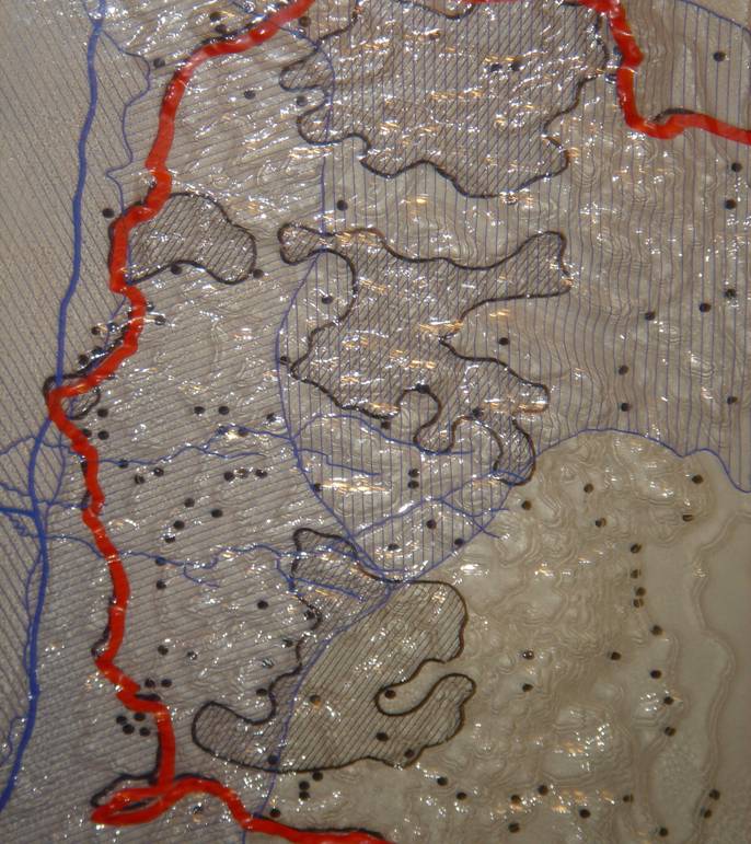
Product of Water Aquifer Israeli Settlements High Density Palestinian Population Overlay, Zoom on North Lobe of West Bank

